The determination of the hash value for each image that has been used here, is used to prevent tampering.
The hash value of the image from the original source must be identical with the copy of the image here on map-base.info.
The underlying procedure to determine a hash value is the MD5 algorithm
 .
Even if just one pixel is changed, it will cause a change of the hash result. .
Even if just one pixel is changed, it will cause a change of the hash result.
To preserve evidence, we recommend that each visitor, should download the images from the original sources
on the own hard disk and to verify the hash value in connection with our images. By doing this
the responsible institutions will lose the option to make changes undetected in hindsight.
|
| Geoglyphs within the Terby Crater |
| Image Source |
Mars Global Surveyor |
| Description |
MOC Image r0401387 |
| Coordinates |
-27.164° N / 74.455° E |
| Target Area |
Northern Part of the Terby Crater |
| Download - Original |
usgs.gov |
| Download - Backup |
map-base.info |
| Hash value - MD5 |
D4C6AF6BA12CBF362BE3B04A94DFA022 |
| Analysis Report |
- 1 -
2 - |
|

Enlarged image detail of the original image
|
|
|
| The plant complex in Aram Chaos |
| Image Source |
Mars Global Surveyor |
| Description |
MOC image R22-00155 |
| Coordinates |
2.63° N / -19.70° E |
| Target Area |
Eastern Terrain of Aram Chaos |
| Download - Original |
msss.com |
| Download - Backup |
map-base.info |
| Hash value - MD5 |
F3C6A306552FC76737B7E47672047276 |
| Analysis Report |
- 1 - |
|

Enlarged image detail of the original image
|
|
|
| The Facility Complex in Aram Chaos |
| Image Source |
Mars Global Surveyor |
| Description |
MOC image M11-00099 |
| Coordinates |
3.11° N / 340.53° E |
| Target Area |
Eastern Terrain of Aram Chaos |
| Download - Original |
msss.com |
| Download - Backup |
map-base.info |
| Hash value - MD5 |
B8BDEC2B215F85CBF8FCBEB7B85A6CAA |
| Analysis Report |
- 1 - 2 -
3 - 4 - |
|

Enlarged image areas of the original image
|
|
|
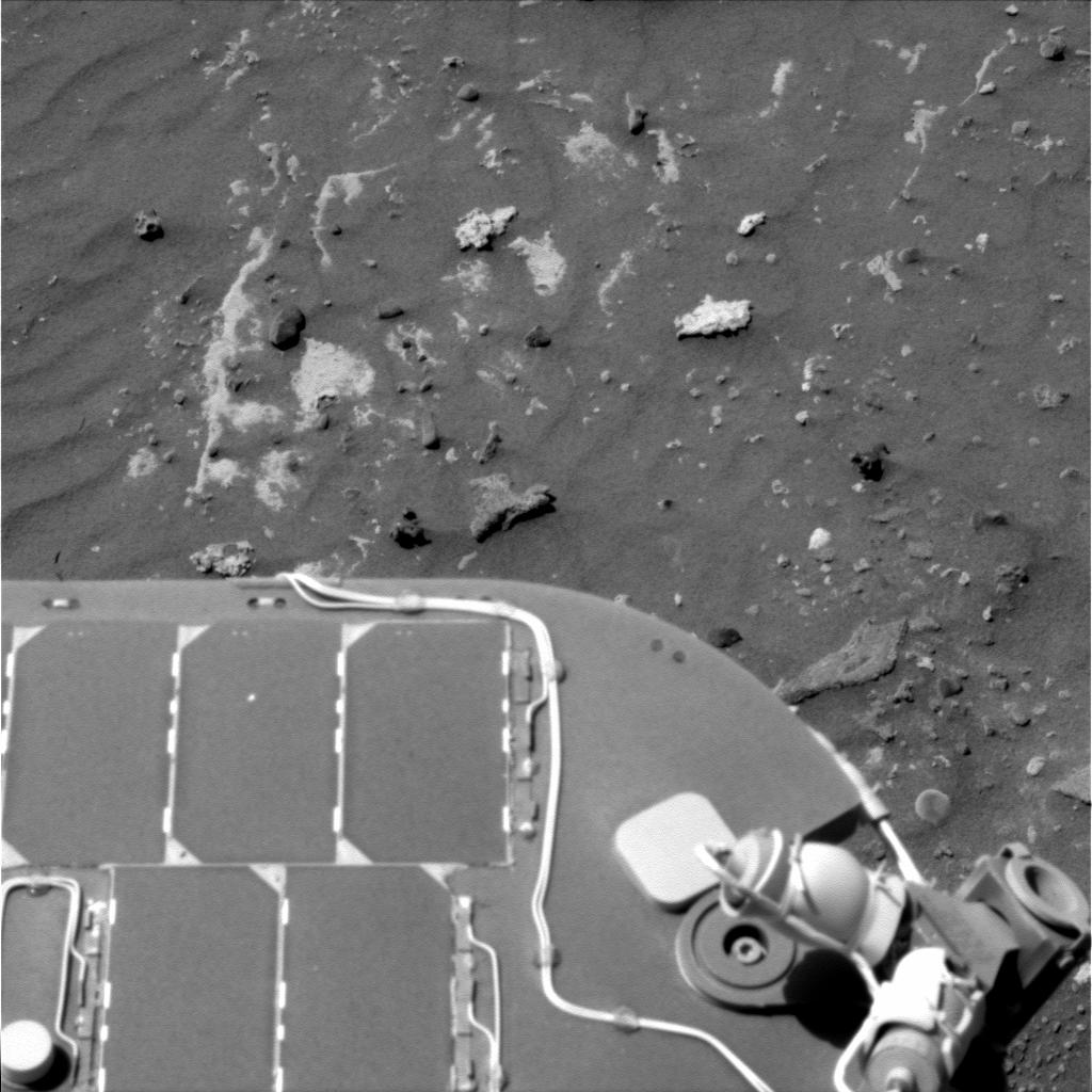
| Carved stone heads in the Conception crater |
| Image Source |
Mars Exploration Rover - Opportunity |
| Description |
1p320037373effabeip2379l2m1
1p320037406effabeip2379l5m1
1p320037569effabeip2379l7m1 |
| Coordinates |
-2.1° N / 354.5° E |
| Target Area |
Conception Crater |
| Download - Original |
nasa.gov -
[1]
[2]
[3]
|
| Download - Backup |
map-base.info -
[1]
[2]
[3]
|
| Hash values MD5 |
1] 7C9BFCD6F1C3B098EABC9660C3CDC06B
2] 69D04EE1ACE1F24BDF5F1FBD92519880
3] B6E537B0D7F8373F3EB415141364E7A3 |
| Analysis Report |
- 1 - |
|

Enlarged image section of the color calculated original image
|
|
|
| Stone hill structure in the Gusev crater |
| Image Source |
Mars Exploration Rover - Spirit |
| Description |
2P191002092EFFAMOAP2443L7M1.JPG
2P191002092EFFAMOAP2443R1M1.JPG |
| Coordinates |
-14.7° N / 175.5° E |
| Target Area |
Central region of the Gusev crater |
| Download - Original |
nasa.gov -
[1]
[2]
|
| Download - Backup |
map-base.info -
[1]
[2]
|
| Hash value - MD5 |
1] 9DE863CC88D8EF1012770E9EA4A009E1
2] F5876D47D7BC866203ECD8F4079FCA99 |
| Analysis Report |
- 1 -
2 - |
|

Enlarged image section of the original image
|
|
|
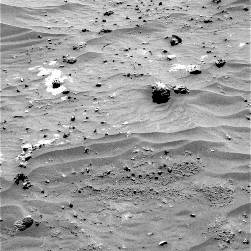
| Rodent-like Skull Inside the Gusev Crater |
| Image Source |
Mars Exploration Rover - Spirit |
| Description |
2P199163397EFFAR00P2283L2M1
2P199163534EFFAR00P2283L3M1
2P199163695EFFAR00P2283L4M1 |
| Coordinates |
-14.603° N / 175.527° E |
| Target Area |
Central region of the Gusev crater |
| Download - Original |
nasa.gov -
[1]
[2]
[3]
|
| Download - Backup |
map-base.info -
[1]
[2]
[3]
|
| Hash values MD5 |
1] 6985729E71F6087C965185724D748852
2] B4CB932CE65CC6FBC950B6A0D7A59C32
3] 2ED62E293A8637C3A6045C8C65176B1F |
| Analysis Report |
- 1 - |
|

Enlarged image section of the color calculated original image
|
|
|
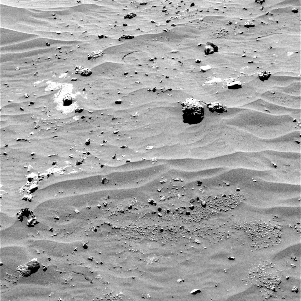
| Spine-like Structure Within the Gusev Crater |
| Image Source |
Mars Exploration Rover - Spirit |
| Description |
2P199072370EFFAR00P2282L3M1
2P199072680EFFAR00P2282L5M1
2P199072917EFFAR00P2282L7M1 |
| Coordinates |
-14.603° N / 175.527° E |
| Target Area |
Central region of the Gusev crater |
| Download - Original |
nasa.gov -
[1]
[2]
[3]
|
| Download - Backup |
map-base.info -
[1]
[2]
[3]
|
| Hash values MD5 |
1] 3DB94FF72A69BF81C772C3CA2F351385
2] C9D9A624B2B18453DDCA9430A3089FCE
3] 6730F7BECD790DD04135D764008016F7 |
| Analysis Report |
- 1 - |
|

Enlarged image section of the color calculated original image
|
|
|
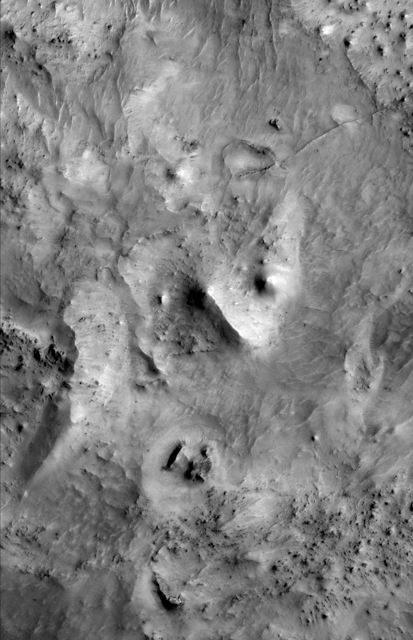
| Ruin in the Northeast of Arabia Terra |
| Image Source |
Mars Global Surveyor |
| Description |
MOC Image M03-04371 |
| Coordinates |
25,520° North / 61,846° East |
| Target Area |
Northeast of Arabia Terra |
| Download - Original |
usgs.gov
|
| Download - Backup |
map-base.info
|
| Hash values MD5 |
40A972EFC5ED32DC48192F9715CA3B48 |
| Analysis Report |
- 1 - |
|

Enlarged image section of the original image
|
|
|
|


