Introduction
We encourage you to verify the source images for yourself, rather than just simply accept the facts that are presented here.
Exact details of the used image templates can be found here.
Some reports on this website are based on previous ones. So it is extremely important to read the reports in chronological order.
Details can turn up that were probably already been analyzed in detail. If you are new here and you directly start reading the
recent reports without prior knowledge, then it could happen, that the required context is not recognizable.
You do yourself and us a favor when you first start with the oldest reports.
This is the first analysis report regarding Aram Chaos. There are no previous reports. You can continue to read here.
Target Area
Image source: Mars Global Surveyor
Labeling: MOC image R22-00155
Coordinates: 2.63 North / -19.70 East
Target Area: Eastern Terrain of Aram Chaos
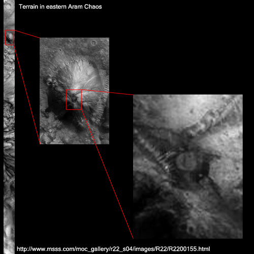
Enlargement of the relevant target areo from the original photo strip
The original image can be quickly found using a search engine, specifying the image name above.
It is also possible to enter the web address in your browser that is included in the above image
or click
here, to directly visit the website.
Artificial Structure in the Overall View
Striking is the structure that is embedded at the tip of this "mountain". Strangely, the oval
structure on the left at the foot of the mountain. Another detail is the path to the right side of
the mountain, which extends from base to tip on the "entering".
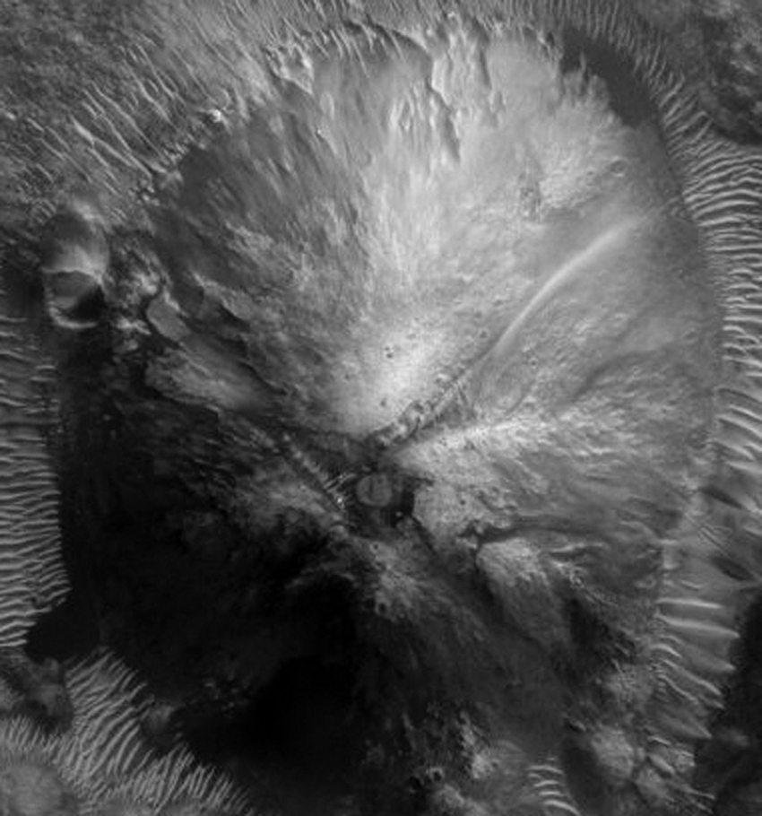
Click on image to enlarge
However, some unusual structures in this object can be explained.
Anomalies in the Vicinity
Briefly noted:
Another remarkable anomaly in the immediate vicinity was discovered as early as 2001.
Report from the Mars Anomaly Research website: Huge Nozzle Shooting Liquid Spray 
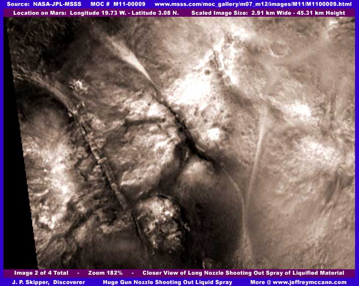
Unnoticed until now remained the unsual structures on the mountain, which is only about eight kilometers to the south of this structure away.
Both findings, however, reinforce the special importance of this place. Aram Chaos is home to more obvious "facilities" than expected.
Due to the immediate vicinity of the conspicuous mountain, this anomaly is going to be analyzed in detail in a later report.
First Details - The Path
Red arrows mark the path that extends from the top to the foot of the mountain.
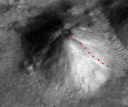
Perspective view - generated with HRSCview
The way in and out would be possible via this route.
But who wants to walk this path (about 1km) up the mountain just to reach the own "working place"?
The procedure would be useful for a larger scale plant as an alternative route. As a kind of escape route or for maintenance.
Therefore, it should also exist a main entrance, which should be suitably located at the foot of the mountain.
More Details - Mysterious Oval Structure
A riddle that causes us headaches was the strange oval structure that is directly located at the mountain.
Only too pleased, we wanted to figure out the true function of this strange object.
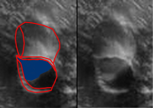
The shape of the structure resembles a giant watering can.
Is this perhaps the view inside the watering can?
Is there a kind of liquid visible inside?
Is the black area the inner edge of the watering can?
A good imagination is very usefull here. The idea of a giant watering can, however, is only the first approximation to the truth.
If it would have some kind of caster, we doubt the usefulness of such a large object. Finally, we want
selectively distribute liquid via the caster. But where? Simply down to the ground? That makes no sense. Why then fill first?
A simple tube should do the job. Maybe into a tanker truck, that stops in front of the watering can? Would also be pointless.
A supply pipe or hose would make much more sense as a giant watering can.
Detail Explained - The Oval Structure
Sometimes it is a good idea to change the perspective ...
The following image section was rotated by 180 degrees and horizontally flipped.
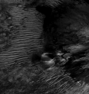
If we look just at the top of the hill, then we shouldn't be able to see the black rear edge of the can.
That would only happen if the can would be very oblique or the image recording was created in a very oblique angle
to the planet's surface. This recording is aligned quite exactly straight down . Looking at the
the overall view of the mountain, especially at the central structure from which we can look up on the mountain we
see almost no shadow. Unless the can is already inclined, but that would make even less sense.
So what do we see?
Here is a magnification that gives more insight.

The edge of the alleged pot reveals a gap in this magnification (marker A). So a can would be relatively meaningless.
In addition, the inner rear edge of the supposed can is not completely black. It appears that the rear ends in a large
black hole (marked B).
However, if this black hole is actually an opening in the mountain, then suddenly it all makes sense.
What we see is not a can-like structure, but a ramp that leads into the interior of the mountain. The main entrance is found!

What had initially served as a liquid, is in reality the soil that leads diagonally to the entrance.
The brighter edges highlight this as the way to the opening. For better orientation in the right image here
a conceptual drawing of the driveway from an angle directly in front of the ramp.
The Central Structure

For now, the importance of the structure which is located at the top of the mountain and slightly recessed into the interior remains unclear.
Is this a cover? A closure? Even the idea of a space vehicle in parking position should not be excluded.
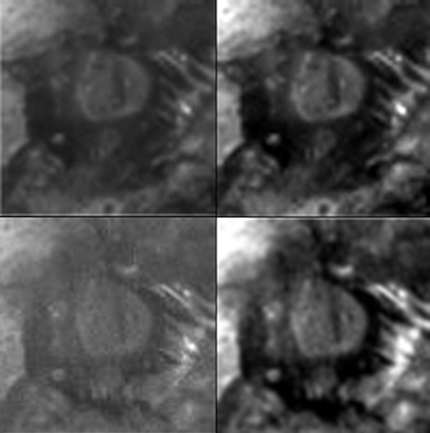
The following image shows on the right two quadrants the excerpts of original recordings from the Mars Global Surveyor Mars spacecraft.
To the left the contrast-enhanced views.
Click on image to enlarge
These pictures show in a very impressive manner that the structural anomaly in the crater opening is hardly to be explained as the
appearance of natural forms. A further analysis of this structure anomaly will follow.
|

